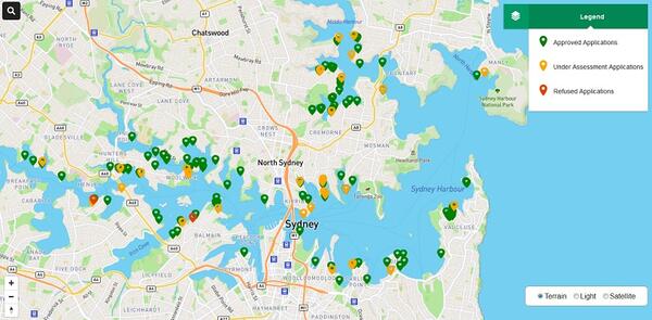
Maritime Applications Map information
The bed of Sydney Harbour, Botany Bay, Newcastle Harbour and Port Kembla Harbour is publicly-owned land.
This land is vested in Transport for NSW (TfNSW) who manages it for the benefit of the people of NSW. Any development, occupation or use of these waterways requires the consent of TfNSW as landowner, in addition to any required planning or construction approvals.
This map allows you to follow the progress of Development Applications requiring approval from TfNSW. This service is part of the Governments ongoing commitment to provide NSW residents with greater transparency.
The Maritime Applications Map is designed to search all Development Applications which are either determined or currently under assessment by TfNSW.
You can search current and recent applications by:
- map location
- address
- reference number.
This service is updated regularly. Please note that it may take a few days for new applications to appear on the map.
About this map
The Maritime Applications Map will only show Development Applications lodged via the e-Lodgement portal.
The map provides a snapshot of key information regarding the application.
This includes:
- status
- site address
- description of work
- date of submission.
- date of determination (if applicable)
- DAM Reference Number (if applicable).
For more information contact Maritime Planning at maritimeplanning@transport.nsw.gov.au.
Project map
Image

Image controls:
