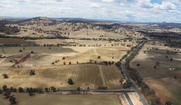
Woomargama Bypass
The 9km bypass to the west of Woomargama, joining the existing Hume Highway divided carriageways to the north and south of the village, opened in 2011.
Image
Image controls:
About the project
The $265 million Woomargama bypass was opened on Monday 7 November 2011.
The Hume Highway Woomargama Alliance designed and constructed the Woomargama bypass. The alliance team comprised Roads and Maritime Services (replacing Roads and Traffic Authority), Abigroup and Sinclair Knight Merz.
The project was funded by the Australian Government.
The Woomargama bypass runs from 8km south of Holbrook where it deviates from the existing dual carriageways before crossing Sandy Creek and passing to the west of Mount McKenzie.
The bypass crosses Mountain Creek and rejoins the recently completed Hume Highway duplication south of Fairburn Road.
Fast facts
- About 1.6 million cubic metres of earthworks was excavated.
- About 72,000 cubic metres of concrete was used for road paving.
- Over 250,000 native plants and shrubs were planted.
- Revegetation occurred in areas outside the road reserve on private property to provide environmental connectivity for fauna.
- An arch fauna crossing was installed under the road for the safe crossing of the threatened Brown Tree Creeper.
- 22 glider poles were installed to help with the safe movement of native fauna, such as the squirrel glider, between native vegetation and the highway.
- Biofuel was used in generators to run the site compound independently of the area's electricity grid.
- Water used on site was pumped from the Hume Weir and Norske Skog paper mill to avoid using the local water supply.
Features
- 4 lane divided carriageway with a wide median and a 110km/h speed limit.
- Intersections located 1.5km south of Woomargama and 6.5km north of Woomargama, with merging acceleration and deceleration lanes, for access into and out of the village.
- Twin bridges over Sandy Creek.
- Twin bridges over Mountain Creek.
- Intersection upgrade at Fairburn Road.
- Deep cuttings of 15m or greater through sections of the western slopes of Mount McKenzie.
- Landscape and urban design treatments to minimise visual impact.
- Environmental controls to minimise impacts on nearby waterways and natural areas.
Benefits
- Removal of most heavy vehicle movements from the village.
- Improved pedestrian safety along the current Hume Highway route in the village.
- Travel time and fuel savings for vehicles moving between Sydney and Melbourne.
- Local traffic separated from Hume Highway through traffic.
- Improved road safety.
Photo gallery
Image


Image controls:
Image


Image controls: