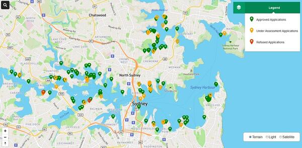
Maritime Applications Map information
Transport for NSW undertakes a consent authority function for certain development in the Foreshores and Waterways Area of Sydney Harbour and its tributaries on behalf of the Minister administering the Ports and Maritime Administration Act 1995.
Further information about Transport for NSW’s consent authority function is detailed in Section 6.25(1) of State Environmental Planning Policy (Biodiversity and Conservation) 2021 and the instrument of delegation at Delegated decisions.
About this map
The Maritime Applications Map provides details about development applications lodged with Transport for NSW that are currently under assessment, and development applications determined by Transport for NSW in the last 12 months.
You can search current and recently determined applications on the map by address, development application reference or by searching the map.
The map provides a snapshot of development application details including:
- application status
- site address
- description of work
- date of submission
- date of determination (if applicable)
- modification application reference number (if applicable).
For more information contact the Maritime Planning and Consent Authority unit at maritimeplanning@transport.nsw.gov.au.
Project map
Image

Image controls:
