Newcastle Inner City Bypass
Project overview
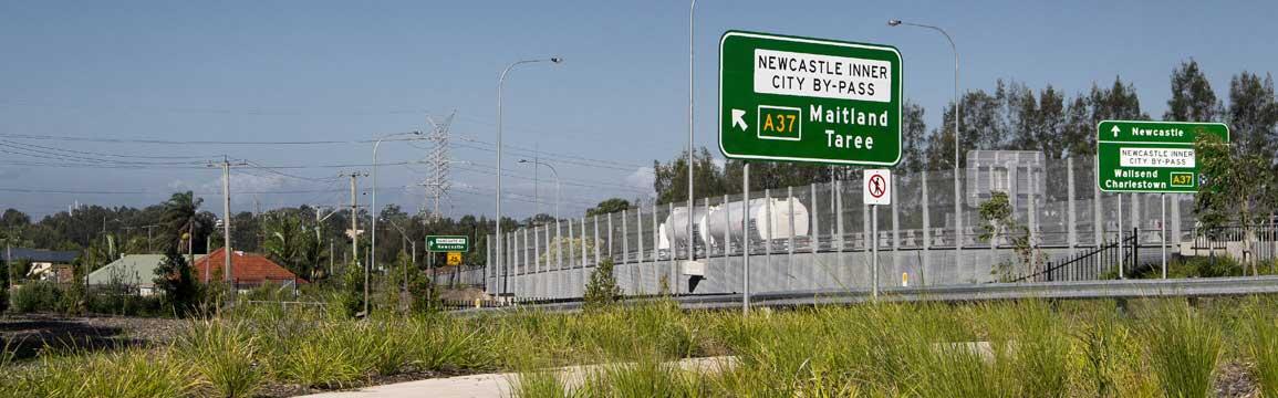
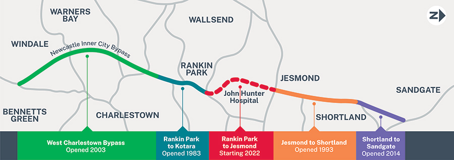
The Newcastle Inner City Bypass between the Pacific Highway at Bennetts Green and the Pacific Highway at Sandgate provides an orbital road linking Newcastle's radial road network.
The Australian and NSW governments are funding the Rankin Park to Jesmond section of the Newcastle Inner City Bypass. The 3.4 kilometre bypass will be built between Rankin Park and Jesmond, to the west of John Hunter Hospital.
View or download the Newcastle Inner City bypass.
Project information
Background
The Newcastle Inner City Bypass is part of Transport for NSW's long-term strategy to provide an orbital road within Newcastle’s road network to connect the Pacific Highway at Bennetts Green with the Pacific Highway at Sandgate.
The bypass provides improved traffic flows across the western suburbs of Newcastle and connectivity to Bennetts Green, Charlestown and Jesmond shopping centres, the John Hunter Hospital precinct at New Lambton Heights and the University of Newcastle at Callahan with connections to the Pacific Highway.
Construction of the Newcastle Inner City Bypass started in the early 1980s.
Sections of the bypass are:
- Kotara to Rankin Park (completed in 1983)
- Jesmond to Shortland (completed in 1993)
- West Charlestown Bypass (completed in 2003)
- Shortland to Sandgate (completed in 2014)
- Rankin Park to Jesmond
Further information: Rankin Park to Jesmond section of bypass.
Community information
Media releases
- 17 March 2021
Inner City Bypass build team digging into Newcastle’s history - 10 March 2021
Shared path bridge now complete - 19 November 2020
Shared path bridge open over Newcastle Road - 11 October 2020
Heavy lifting reaches major milestone over Newcastle Road