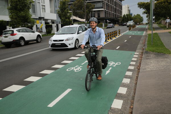
Improving the Bikeability of Our Cities
An interactive scenario planning tool to explore various bicycle infrastructure scenarios and assess their potential impacts.
Image
Image controls:
This research was delivered by the University of NSW in collaboration with Transport for NSW, Wollongong City Council, Penrith City Council, NSW Office of Sport, and Wollongong 2022.
Background
The literature largely recognises a positive correlation between cycling modal share and overall infrastructure supply. However, to determine how best to improve the cycling network, and achieve best returns on investment, requires the development of a planning support tool.
This tool will assist governments to explore bicycle infrastructure scenarios, assess their potential impacts, and make evidence-based decisions. It will also enable planners and analysts to consider the potential for cycling enhancement as broadly as possible and support coordinated and strategic cycling infrastructure planning at local and regional levels.
Objectives
This project delivered the following objectives:
- Identified the full range of underlying factors affecting cycling and current best practices in assessment of cycling potential
- Developed a standardised data collection framework for cycling research by assessing the pertinence, quality, and quantity of currently available datasets and conducting community surveys to fill identified data gaps
- Developed a cycling model and derived indices of cycling accessibility and cycling network connectivity of any proposed bikeway options
- Built and tested an interactive cycling Scenario Planning Tool, which considered existing and proposed transport infrastructure, land use and the built environment, socio-demographic variables and topographic factors. These factors were used to estimate current and future cycling activity levels and the impact of new cycling infrastructure.
Key Deliverable
This research project produced the Cycling Infrastructure Scenario Builder, a web-based interactive decision support tool that is designed to help with the planning of cycling infrastructure. The tool enables users to test various cycling infrastructure scenarios on digital maps and estimate cycling uptake resulting from hypothetical new cycling infrastructure. The tool includes a wide range of cycling related maps and data layers to provide contextual information and visual guidance, which enhances the interactive experience while planning for cycling infrastructure.
For more information on the research findings, visit the City Futures Research Centre.
Image
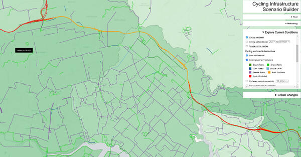
Image controls:
This research was delivered as an Australian Research Council (ARC) Linkage project.
The ARC Linkage Program supports and promotes research partnerships between higher education organisations, industry, community organisations and publicly funded research agencies.
For more information email research@transport.nsw.gov.au