Hawkesbury-Nepean Valley Flood Evacuation Road Resilience Program
Project overview
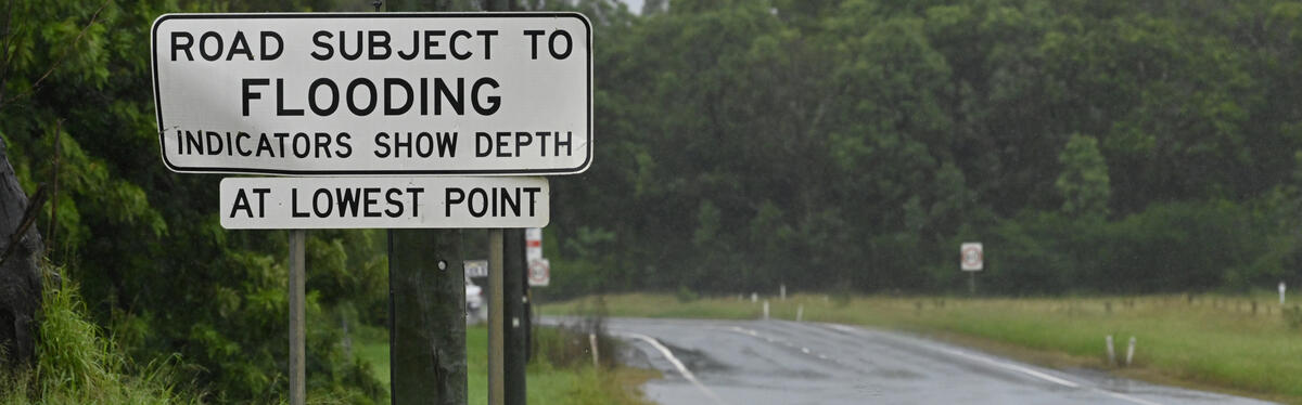
The Hawkesbury-Nepean Valley Flood Evacuation Road Resilience Program aims to improve flood evacuation routes to better withstand local flash flooding and increase the number of cars that can evacuate during major flooding events.
The proposal includes around 100 improvements across the Penrith, Hawkesbury, The Hills and Blacktown local government areas along and around the flood evacuation routes.
Program information
What is the Hawkesbury-Nepean Valley Flood Evacuation Road Resilience Program
The NSW and Australian Governments have committed $33 million towards planning for around 100 infrastructure improvements that will help people evacuate safely ahead of a flood in the Hawkesbury-Nepean Valley.
The Hawkesbury-Nepean Valley Flood Evacuation Road Resilience Program aims to improve flood evacuation routes to better withstand local flash flooding and increase the number of cars that can evacuate during major flooding events.
The Program proposes around 100 improvements across the Penrith, Hawkesbury, The Hills and Blacktown local government areas.
The proposed work will raise some sections of road and improve drainage at key low points to make the evacuation network more resilient to flash flooding and stay open for longer. To help increase road capacity during major flood events, shoulder widening will provide a second evacuation lane to help evacuate as many people as possible.
To enhance the performance of evacuation routes, pinch point improvements are proposed to mitigate existing road capacity constraints at intersections that could impede the safe evacuation of residents from flood affected areas.
A bridge structure has been proposed to keep the evacuation route open for the longer, in the event of localised flash flooding.
The improvements are based on extensive flood modelling and consultation with the NSW State Emergency Services (SES) and NSW Reconstruction Authority (NSWRA).
We are continuing to work on environmental assessments and designs for other flood evacuation routes. We will engage with local communities further as we progress.
View the locations of proposed improvement map (PDF, 7.21 MB)
Addressing flood risk in the Hawkesbury-Nepean Valley
The Hawkesbury-Nepean Valley (the Valley) has the highest flood exposure in NSW due to its unique landscape and large existing population. Floods in the Valley can have a significant impact on people’s lives, livelihoods and homes.
There is no single solution to managing or reducing the Hawkesbury-Nepean Valley’s high flood risk. NSW Reconstruction Authority is developing a Disaster Adaptation Plan (DAP) that will include a suite of integrated measures to reduce risk where possible and adapt where the risk cannot be adequately reduced. For more information on the DAP, visit: www.nsw.gov.au/reducingrisk/dap
Previous flood work in the valley
The NSW Government has been working in the Valley for many years to understand the impact of floods and reduce risk to life and property. The 2024 Hawkesbury-Nepean River Flood Study provides the most up to date, reliable information on how floods impact 8 local government areas. It will be a key input into the Hawkesbury-Nepean Valley DAP.
The 2024 study builds on and complements the regional 2017 Resilient Valley, Resilient Communities – Hawkesbury-Nepean Valley Flood Risk Management Strategy (PDF 5.37Mb).
Outcomes from the 2017 Flood Strategy will continue to be delivered alongside development of the DAP and Transport for NSW has an important role in leading road and transport outcomes, including:
- coordinating the development of a regional evacuation model that identifies the flood evacuation capacity requirements for different areas in the valley
- developing Regional Evacuation Road Guidelines that identify the flood evacuation road network design requirements for the valley
- design and rollout of flood evacuation road signage across the valley (completed)
- planning for targeted flood evacuation road infrastructure improvements for local and regional flooding to enhance access to and resilience of the existing flood evacuation routes (the Program)
Next steps
We are continuing to work on environmental assessments and designs for other flood evacuation routes. We will engage with local communities further as we progress.
For the latest information on the Hawkesbury-Nepean Valley Flood Evacuation Road Resilience Program, subscribe to our project updates by sending an email to hnvferrpinfo@transport.nsw.gov.au
Past News
October 2024 - Have your say on proposed drainage improvements on Springwood Road
We have developed the design for the proposed drainage improvements on Springwood Road. This is one part of the Hawkesbury-Nepean Valley Flood Evacuation Road Resilience Program.
Proposed improvements include:
- upgrading drainage at key low points along Springwood Road and Rivatts Drive to keep the road open for longer during flooding events
- installing new culverts and constructing mounds to direct water away from roads into drainage
- adjusting utility services as required (electrical, gas, water and communication lines)
- resurfacing roads where new drainage is being installed.
Map of proposed drainage improvements on Springwood Road

View larger version of image (PDF, 1.63 MB)
More information can be found in the October Community Update (PDF, 916.51 KB).
The feedback period for the proposed improvements along Springwood Road closed on Sunday 24 November 2024. We thank the community and stakeholder for their feedback during this time.
We are now collating and considering all feedback received. While this period of consultation has closed, we will continue to keep the community up-to-date as the project progresses.
July 2024 - Have your say on proposed improvements to The Northern Road and Londonderry Road Flood Evacuation Routes
We have developed the Review of Environmental Factors (REF) for the proposed improvements along The Northern Road and Londonderry Road flood evacuation routes. This is one part of the Hawkesbury-Nepean Valley Flood Evacuation Road Resilience Program.
Location of proposed improvements along The Northern Road and Londonderry Road Flood Evacuation Routes

The proposed improvements include:
- upgrading drainage along The Northern Road flood evacuation route to help better withstand flash flooding and keep the road network open for longer
- providing an emergency lane to be used during flood evacuations on The Northern Road and Londonderry Road by widening the southbound road shoulder for around 20 kilometres
- raising low points along sections of The Northern Road to allow the road to stay open longer during local flash flooding
- minor adjustments at four intersections of the flood evacuation routes to provide an additional evacuation lane
- adjustments to existing driveways, footpaths, bus stops, cycleways, street signs and lighting, and utility services(electrical, gas, water and communication lines)
- installing new signs to use during emergency flood evacuations to enable the widened road shoulder to be an additional evacuation lane
- landscaping at selected locations.
The REF outlines the concept design and assesses a range of potential environmental impacts expected during construction and operation. The REF includes how we plan to minimise these impacts to our environment and the community.
To find out more view the Community Update (PDF, 1.99 MB), maps of proposed road raising locations (PDF, 13.68 MB) and Frequently Asked Questions (PDF, 173.95 KB). For more details, please view the REF under Project documents on the bottom of this page.
We would like to thank the community for attending our online information session on 7 August 2024. View the recorded session.
The feedback period for Review of Environmental Factors (REF) for the proposed improvements along The Northern Road and Londonderry Road flood evacuation routes closed on Tuesday 20 August 2024. We thank the community and stakeholders for their feedback during this time.
A Submissions Report to summarise the feedback received for the project and our responses will be prepared and published.
While this period of consultation has closed, we will continue to keep the community up-to-date as the project progresses.
October 2023 – Concept design, current planning stage and continuing investigation work
Transport for NSW is developing the concept design and Review of Environmental Factors (REF) for the improvement projects identified in the Flood Evacuation Road Resilience Program.
Planning work has already started across all improvement areas, including site investigations to inform the concept design development and environmental assessment of identified improvements.
Survey, utility, environmental and geotechnical investigations have now been underway since late 2022 and will continue until the end of 2024. We are now carrying out investigation work at private properties and are contacting property owners to arrange access.
Read the full October 2023 Project Update (PDF, 4.5 MB).
December 2022 – Investigation work on The Northern Road and Londonderry Road
Transport for NSW will carry out investigations from Monday 12 December to Friday 28 April 2023. Work will include ground survey, geotechnical investigations involving drilling boreholes, test pits and core drilling to test soil and road conditions.
Read the project update on the Dec 2022 investigation work (PDF, 420.44 KB).
August 2022 – Concept design and current planning stage
Transport for NSW is working closely with local councils on the planning of the improvements across state, local and regional roads.
Planning work will commence from August, including site investigations to inform the development of identified improvements.
Preliminary site investigation works will be undertaken across the four Local Government Areas of Penrith, Hawkesbury, Blacktown and The Hills.
Site investigation work
Investigations will include survey, utility, environmental and geotechnical investigations.
Transport will soon be in contact with property owners where we require access to private property to carry out the investigations.
Project documents
Some documents on this page may not comply with accessibility requirements (WCAG).
If you are having trouble accessing information in these documents, please contact us.
The Northern Road and Londonderry Road Evacuation Routes - Review of Environmental Factors Documents
- July 2024 - Review of Environmental Factors - Proposed improvements on The Northern Road and Londonderry Road Flood Evacuation Routes Main report including Appendices A, B and C (PDF, 90.04 MB)
- Appendix D – Biodiversity assessment (PDF, 39.26 MB)
- Appendix E – Noise and vibration impact assessment (PDF, 157.95 MB)
- Appendix F – Traffic and transport impact assessment (PDF, 13.15 MB)
- Appendix G – Aboriginal cultural heritage assessment (PDF, 7.23 MB)
- Appendix H – Historic heritage impact assessment (PDF, 13.06 MB)
- Appendix I – Landscape character and visual impact assessment (PDF, 73.52 MB)
- Appendix J – Socio-economic impact assessment (PDF, 2.14 MB)
- Appendix K – Preliminary site investigation (PDF, 66.76 MB)
- Appendix L1 – Hydrologic and hydraulic assessment main report (PDF, 4.51 MB)
- 2a Appendix L Flooding Figures 1 (PDF, 189.73 MB)
- 2b Appendix L Flooding Figure 2 (PDF, 186.47 MB)
- 3 Appendix L Flooding Annexure A (PDF, 16.24 MB)
- 4 Appendix L FIooding Annexure B (PDF, 82.64 KB)
- 5 Appendix L Flooding Annexure C (PDF, 40.89 MB)
- 6 Appendix L Flooding Annexure D (PDF, 70.26 MB)
- 7 Appendix L Flooding Annexure E (PDF, 92.67 MB)
- 8 Appendix L Flooding Annexure F (PDF, 71.3 MB)
- 9 Appendix L Flooding Annexure G (PDF, 68.77 MB)
- 10 Appendix L Flooding Annexure H (PDF, 186.27 MB)
- Appendix M – Soils, surface and groundwater impact assessment (PDF, 27.08 MB)
- Appendix N – Air quality and Greenhouse Gas assessment (PDF, 2.51 MB)
- Appendix O – Concept Design General arrangement (PDF, 78.66 MB)
Useful documents
Project updates
- October 2024 project update (PDF, 916.51 KB)
- July 2024 project update (PDF, 1.99 MB)
- October 2023 project update (PDF, 4.5 MB)
- August 2023 Investigations continue along Andrews Road (PDF, 542.23 KB)
- June 2023 Investigations along Andrews Road (PDF, 408.8 KB)
- August 2022 project update
- Dec 2022 investigation work (PDF, 420.44 KB)
Contact us
For further information about the program, please contact:
Phone: 1800 684 490
Email: hnvferrpinfo@transport.nsw.gov.au
For questions relating to flood risk reduction in the Hawkebury-Nepean Valley, please contact the NW Reconstruction Authority.