Bandon Road Corridor Upgrade and Extension - North West Growth Area
Project overview
The Federal Government has committed $75 million in addition to NSW Government’s initial $75 million to progress the planning of the new Bandon Road corridor at Vineyard; in line with the previously finalised Bandon Road corridor completed in 2019.
The new Bandon Road corridor runs between Richmond Road, Marsden Park and Windsor Road, Vineyard. Bandon Road is part of the North West Growth Centre Road Network Strategy.
The Federal Government and NSW Government have committed a total of $150 million to progress the planning for the Bandon Road Corridor Upgrade and Extension project.
With additional funding allocated for the corridor, Transport for NSW is commencing the concept design phase.
The funding committed will enable Transport for NSW to recommence the upgrade project, undertake the necessary investigations, engage with stakeholders and the community and prepare a concept design, environmental assessment and business case for the future delivery of identified priority works.
Transport for NSW will liaise with key stakeholders and residents along the corridor as the project investigations progress.
Latest news
Arup Australia Pty Limited has been awarded the contract for the Concept Design and Review of Environmental Factors (REF) of the Bandon Road Upgrade and Extension project. While the concept design and review of environmental factors is being developed, we have identified an early safety works opportunity to improve safety for pedestrians and motorists at Vineyard Station.
Feedback for the Early Safety Works proposal closed on Sunday 6 April 2025.
Project updates
Arup Australia Pty Limited has been awarded the contract for the Concept Design and Review of Environmental Factors (REF)t of the Bandon Road Upgrade and Extension project.
Over the next year the concept design and review of environmental factors report will be developed with the community consultation planned in Q2 2026.
As part of this design, an early safety works project has been identified at the corner of Riverstone Parade and Bandon Road, which will improve safety for pedestrians and motorists and access to Vineyard Train Station.
- October 2024 - Additional funding announced and next steps (PDF, 6.91 MB)
In 2019, Transport for NSW notified the community that Bandon Road Corridor was finalised after consultation with the community in August 2016. The project has now progressed to the concept design, environmental planning and Review of Environmental Factors. - July 2019 - Bandon Road Corridor finalised
Project notifications
- March 2025 community update (PDF, 560.94 KB)
Awarded contract to Arup Australia Pty Ltd to develop Concept Design and REF, including early safety works at Vineyard Station – Have Your Say - October 2024 community update (PDF, 6.91 MB)
Australian and NSW Government funding announced - February 2017 project notification
Field investigations near Bandon Road, Vineyard from Monday 27 February to Friday 10 March 2017. - August 2016 project notification
Bandon Road Preferred Corridor - Have your say.
Project information
Overview
The Bandon Road Upgrade and Extension Project connects Richmond Road, Marsden Park and Windsor Road, Vineyard through Marsden Park North, Riverstone West, Riverstone and Vineyard precincts.
This corridor will provide an extra road connection between Richmond Road and Windsor Road and reduce traffic congestion within Riverstone and provide alternative access across the North West Growth Area.
The finalised Bandon Road corridor is part of the North West Growth Centre Road Network Strategy.
The Bandon Road corridor was finalised in 2019. Community consultation on the preferred Bandon Road corridor started in August 2016. Finalising this corridor was the result of a formal consultation process and community and stakeholder engagement carried out over several years. This finalised corridor has been sent to NSW Department of Planning, Housing and Infrastructure to include in precinct plans for the North West Growth Area.
Benefits
The finalised corridor will:
- provide an extra connection between Richmond Road and Windsor Road
- reduce congestion in the Riverstone Town Centre by providing a road underpass of the Richmond railway line at Vineyard
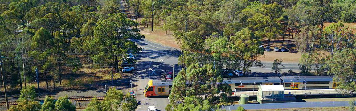
- improve access to Vineyard railway station
- improve road and railway safety by removing level crossings in Vineyard
- improve access to Riverstone Industrial Area, Marsden Park, Marsden Park North, Riverstone West, Riverstone and Vineyard precincts
- allow for local and cross regional pedestrian and cyclist access needs
- provide an upgrade and realignment of existing flood evacuation route on Wallace Road and Bandon Road
- increase road capacity to meet the future needs of the North West Growth Area.
Features
The preferred corridor includes:
- a new four lane divided road including a central median to allow for future widening
- an off-road shared path for pedestrians and cyclists
- a new road underpass of the Richmond railway line at Vineyard
- traffic light intersections and a central median to improve road safety
- two bridges across the flood plain
- two flood plain storage excavation areas to compensate for embankments at Bandon Road
- an upgrade and realignment of the existing flood evacuation route on Wallace Road.
Reports
- June 2016 options report
Bandon Road Upgrade between Richmond Road, Marsden Park and Windsor Road, Vineyard.
Next steps
We are currently developing concept design and environmental assessment. Once this is complete, we then:
- display the Review of Environmental Factors seeking Community Feedback
- consider Community Feedback and prepare Submissions Report
- gain approval to proceed
- detailed design*
- construction.*
*Subject to funding.
Map

Some documents on this page may not comply with accessibility requirements (WCAG).
If you are having trouble accessing information in these documents, please contact us.
Subscribe to stay up to date
We will keep the community informed as the project progresses. To receive updates about the project, please fill in the subscription form below.
Contact us
For further information about this project, please contact:
Phone: 1300 367 561
Email: nwga@transport.nsw.gov.au
Privacy Statement: Transport for NSW is committed to protecting your personal information. We will not publish or disclose your personal information to any third parties unless you consent or as authorised by law. Aggregated or depersonalised information which does not identify you, such as summary tables, may be published or disclosed to third parties. Providing personal information is voluntary, however we rely on your participation to ensure the accuracy and reliability of the information obtained and we may not be able to communicate with you directly if you do not provide your personal information.
Your information will be managed by Transport for NSW in accordance with the Privacy and Personal Information Protection Act 1998 and the Health Records and Information Privacy Act 2002. For further information, please see our Privacy Management Plan or contact us at privacy@transport.nsw.gov.au. If you wish to access, correct or remove the personal information collected by us you can email nwga@transport.nsw.gov.au.